Initial Steps
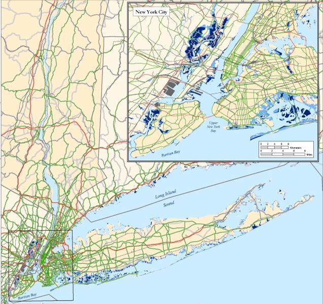
- Doing a fine research on the sea level rise impact over east coast
- Trying to combine the sea level impact over economy of the coastal states
- What can be the different areas of economy impact that we can concentrate on?
- Critical Infrastructure
- Transportation Infrastructure
- Agricultural Infrastructure
- Marine Habitat
Data Abstraction
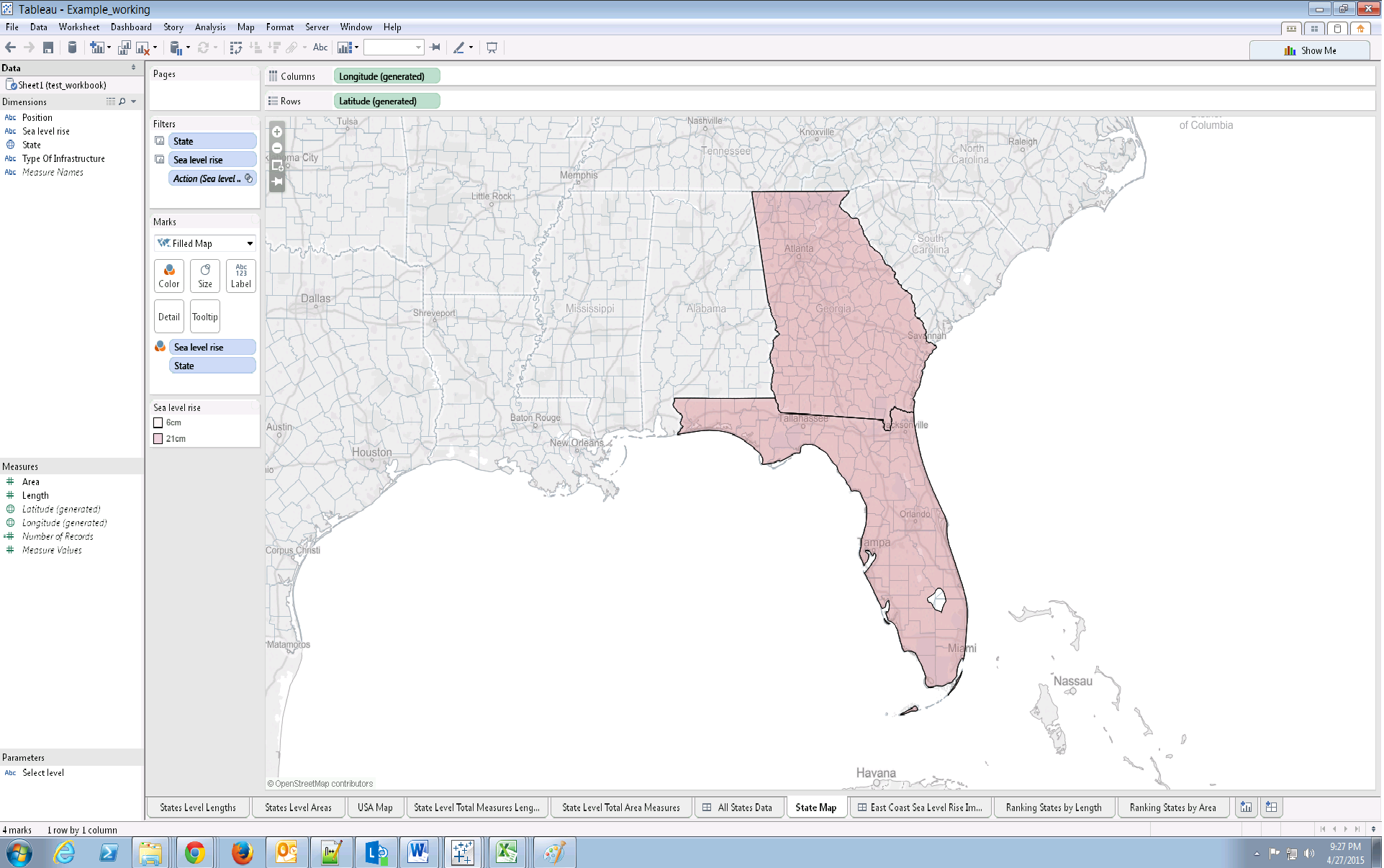
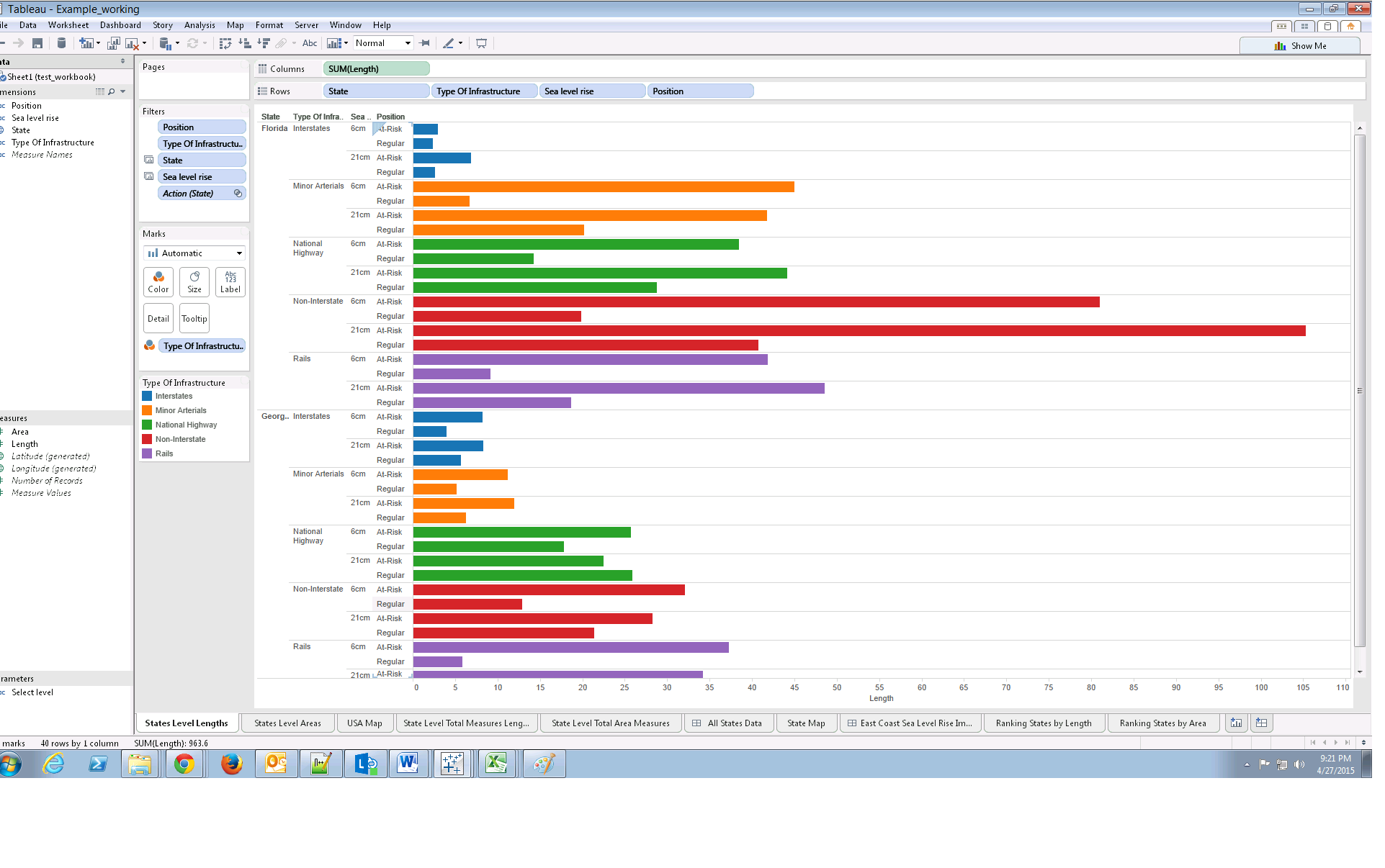
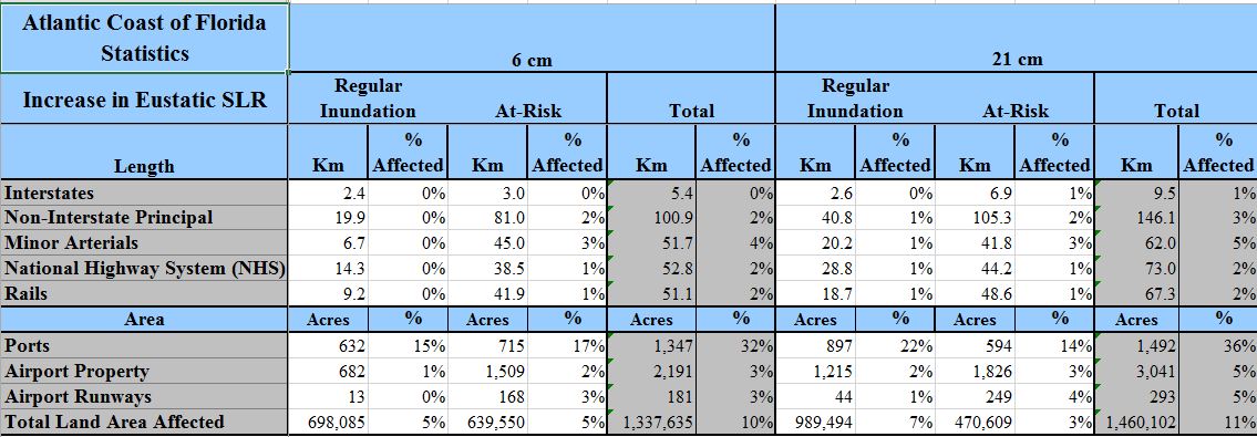
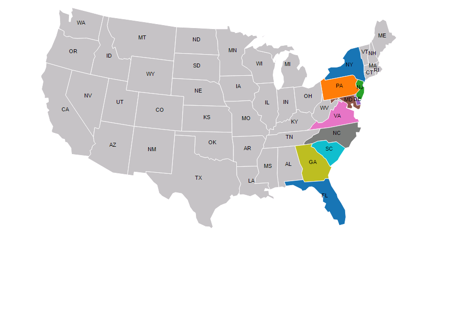
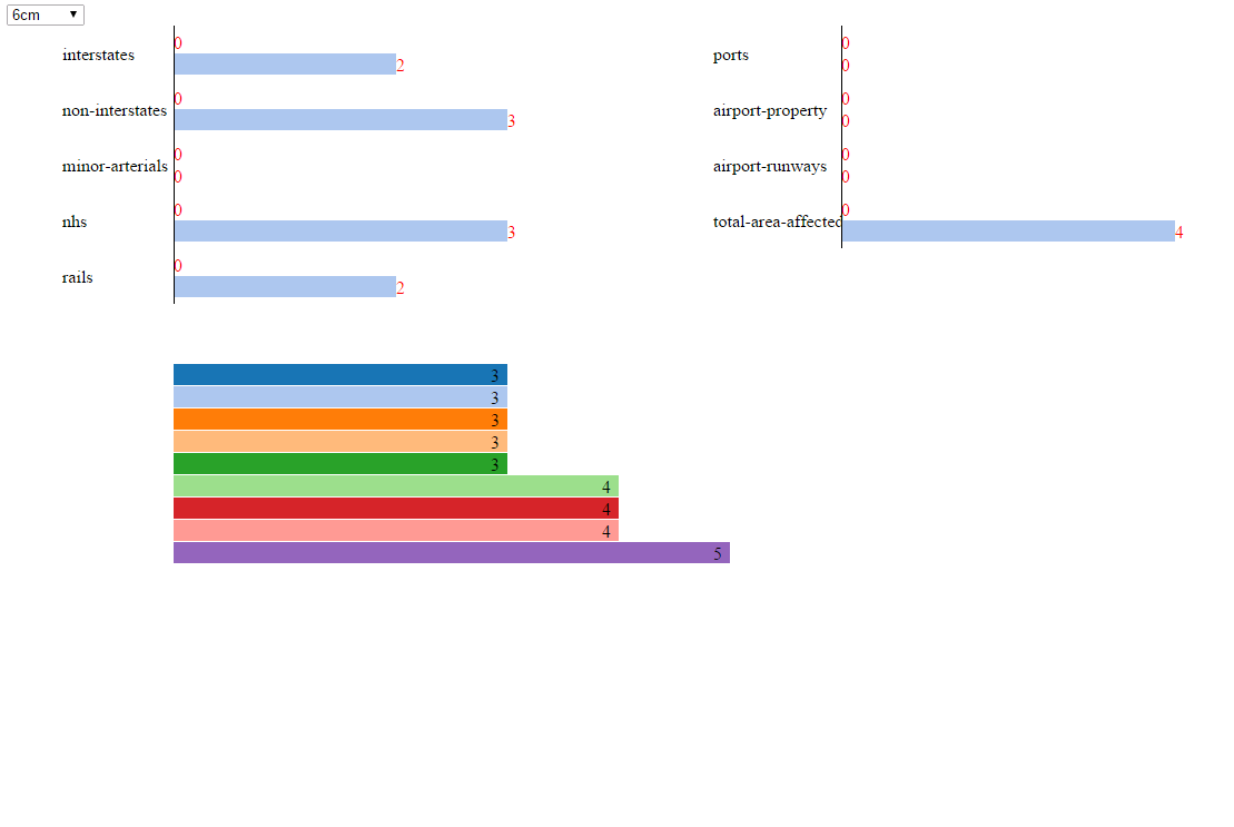
- We finalized to work forward with sea level impact on transportation infrastructure
- Initial Data Sample
- Data accessed from the following link
Progress
- Data Cleaning
- D3 Map Implementation
- Working with GeoJson and TopoJson files to extract the map and the state
Current Projection
- We initial started working on the data using D3 Javascript, as our project focuses more towards a specific domain it was mandatory for us to concentrate on using the map projection
- Our plan was to try and project the interstates, non-interstate, highways etc on to the map, but we were coming across a lot of issues in setting up the co-ordinates for all the specification
- Hence we had to change our plan of working along with Tableau
Visualization